High-precision
aerial inspection
Professional drone services for mining, energy & industry. Accurate data, safe operations, record-breaking delivery times.
8 specialized services with our own fleet
9 latest-generation DJI drones, certified industrial sensors and RTK modules for centimetric precision.
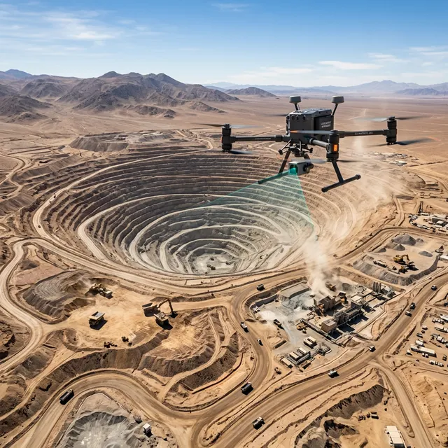
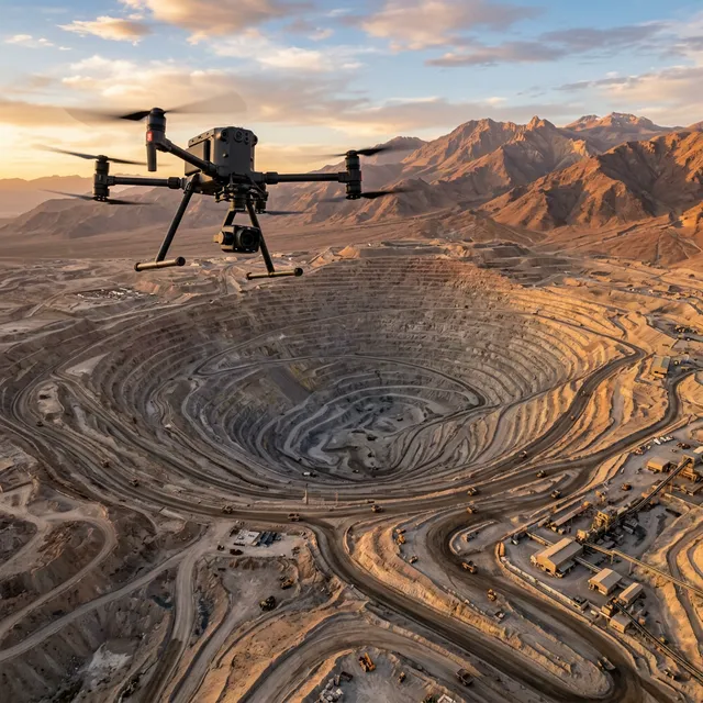
LiDAR Topography & Photogrammetry
3D point clouds, orthomosaics, DEM/DSM with RTK centimetric precision. Covers 120 ha in 2 days vs 3+ weeks traditional.
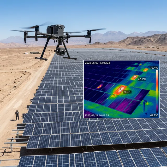
Thermography & Thermal Inspection
Thermal maps, hotspot detection in solar panels, power lines and leaks in industrial plants. 640×512 radiometric sensor.
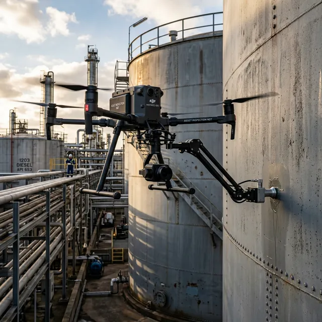
NDT Thickness Measurement
Ultrasonic non-destructive testing per API 653 for chimneys, tanks, pipes. No scaffolding needed — 85% cost reduction.
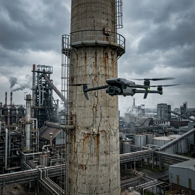
Visual Structural Inspection
Tower, chimney, bridge and antenna review with optical zoom and FPV. Crack, corrosion and damage detection.
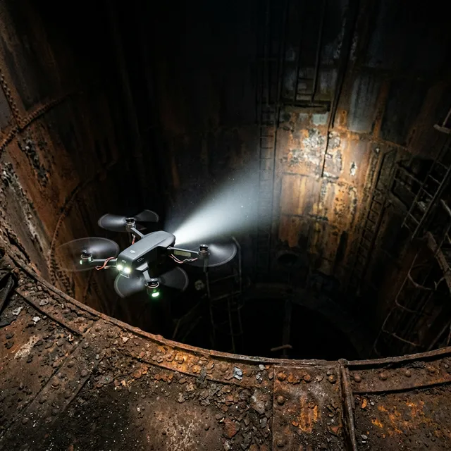
Interior & Confined Spaces
Inspection of warehouses, tunnels, boilers, silos and confined spaces without human exposure to risk.

Cinematic Video & Photography
5.1K/4K Hasselblad production for corporate reports, real estate, marketing and construction documentation.
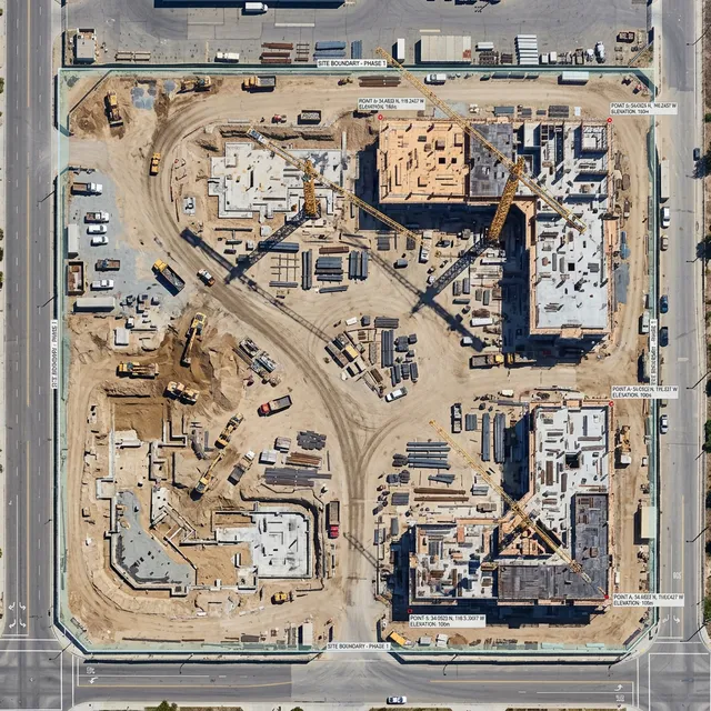
Construction Progress Monitoring
Periodic progress reports, temporal comparisons and sequential orthomosaics with RTK centimetric precision.
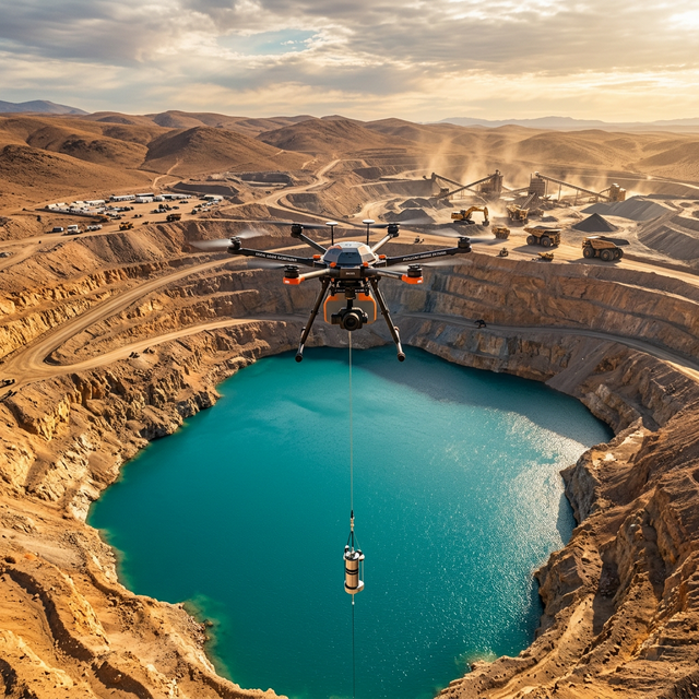
Pitlake Water Sampling
Water sampling in pitlakes and tailings ponds with heavy-lift drone. No boat needed, zero human risk.
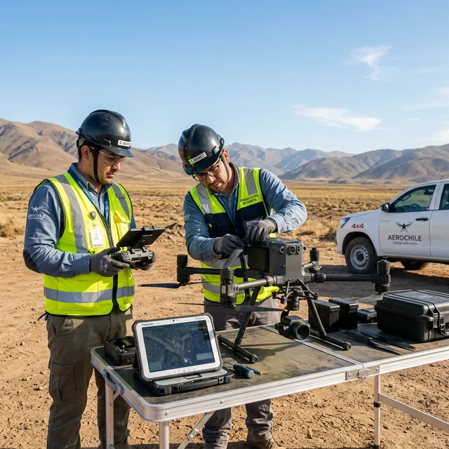
The expertise your operation needs
We are certified operators with years of experience in the most demanding environments in Chilean industry.
DGAC & RPAS Certified
We operate with all certifications required by Chile's aviation authority.
9 drones + RTK modules
Mavic 3 Pro Cine, Mavic 4 Pro, Matrice 400 (LiDAR + Thickness), Matrice 4T/4E, Neo, FPV and FlyCart 30.
Operational safety
Rigorous flight protocols ensuring zero incidents across 500+ operations.
Part of MCCO Group
Backed by 20+ years of engineering experience serving CODELCO and major mining operations in Chile.
Frequently Asked Questions
ConDron offers 8 specialized services: LiDAR topography & photogrammetry, thermographic inspection, NDT thickness measurement (API 653), visual structural inspection, interior & confined spaces, 5.1K/4K cinematic video, construction progress monitoring, and pitlake water sampling. We operate a fleet of 9 DJI enterprise drones with RTK modules.
Yes, ConDron holds an AOC (Air Operator Certificate) and RPAS pilot licenses issued by Chile's DGAC under DAN 151 and DAN 91 regulations. We manage all flight permits for clients at no extra cost.
Reference prices per day: Video/Photo 4K from 12 UF (~$500 USD), Photogrammetry + Inspection from 25 UF (~$1,000 USD), Industrial NDT + Thermography from 40 UF (~$1,600 USD). Contact us for a personalized quote.
We use DJI Matrice 400 drones equipped with PTG6/PTG8 ultrasonic sensors that land on metal surfaces to measure wall thickness per API 653 standard. This eliminates scaffolding — 85% cost reduction and zero safety risk.
We operate across all of Chile from our Santiago base. Main areas include Santiago Metropolitan, Antofagasta, Atacama, Coquimbo and Valparaíso. 500+ flights completed in mining, energy and industrial projects.
Our fleet includes 9 DJI drones: Matrice 400 (LiDAR L3 + NDT PTG6/PTG8), Matrice 4T (640×512 thermal), Matrice 4E (56MP photogrammetry), Mavic 4 Pro (100MP), Mavic 3 Pro Cine (Hasselblad 5.1K), Neo (ultracompact interiors), FPV Mini (confined spaces), and FlyCart 30 (30kg heavy-lift). All enterprise drones are RTK-capable.
Video and photography: 48 hours. Photogrammetry, inspection reports and NDT reports: 48-72 hours. Rush service available (<72h with surcharge).
Use our online calculator, fill out the contact form below, email [email protected], call +56 9 7986 0843, or reach us via WhatsApp 24/7.
Request a Quote
Tell us about your project and we'll get back to you within 24 hours with a personalized proposal.
Location
Santiago, Chile
Operates nationwide